Day 48: Valle Tio Vences Campground to Beaverhead Work Center - 69 miles
Bruce had left early in the morning to go scouting and he left me his card with a request for my web address. I left it under a rock outside his tent, and I was envious at the much more comfortable setup that he had compared to my tiny one person tent.
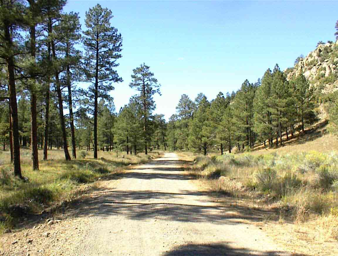
I was on the road by 10:00 and it was a brilliant morning. The sun was shining and there was not a cloud in the sky. The wind was behind me and I had a downgrade through this lovely forest. What bliss.
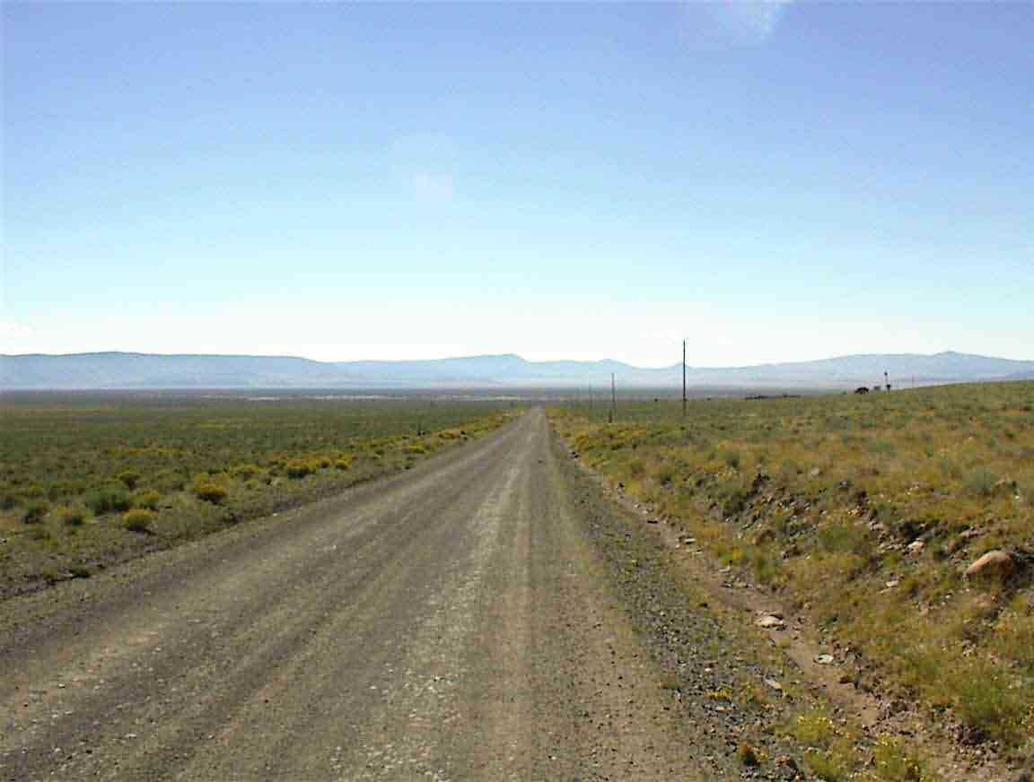
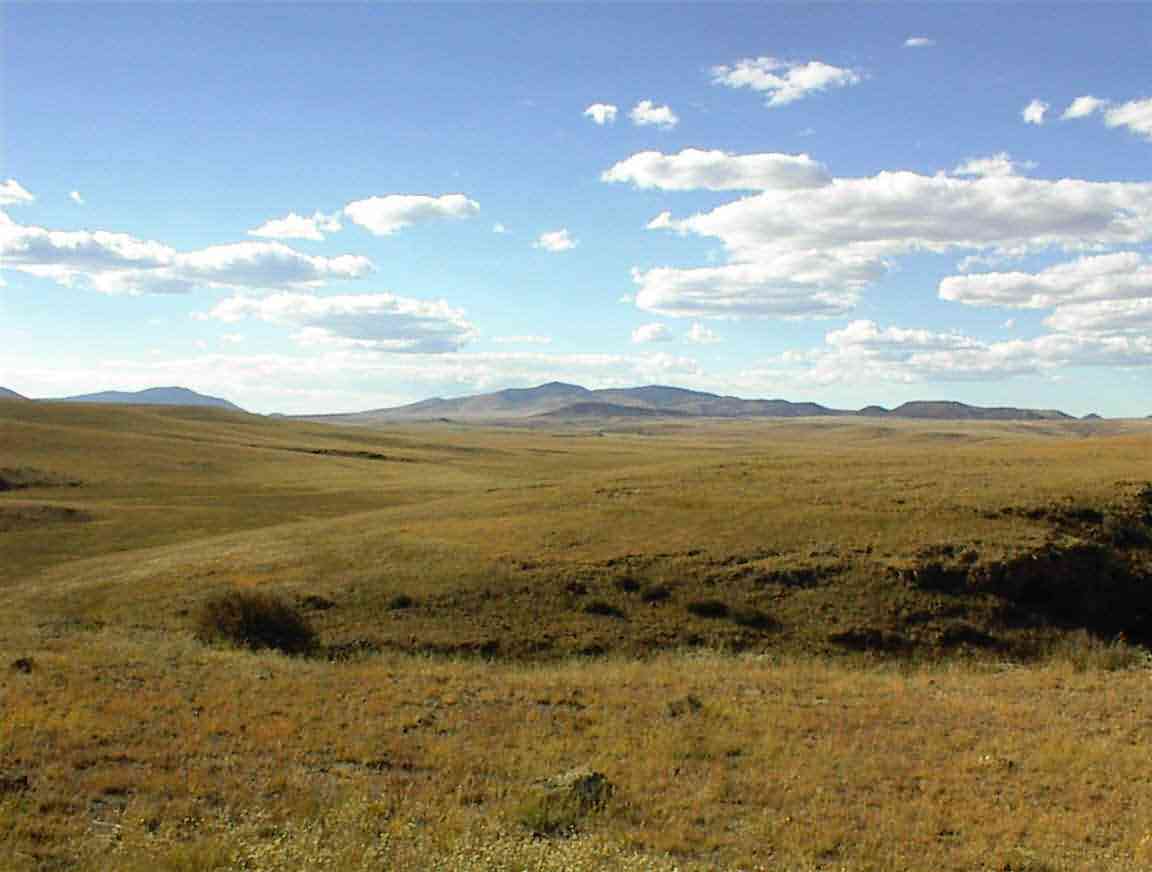
It was to be a day of many terrain changes and for the first 10 miles it was forest travel. Eventually I emerged from the woods and was given the view below. The area is called the 'Plains of San Agustin' which is the bed of an old lake. The route took me along the edge of the plain and it was just so desolate. Except for a small herd of cattle, there was nothing as far as I could see.
If there is anything which shows a department has a surfeit of money, it is the placement of useless signs in inappropriate locations. Usually these consist of stop signs at intersections which get about 1 car per week, but the sign below was quite memorable. Placed in the middle of a dry, desert area it cautioned against polluting the lakes and rivers.
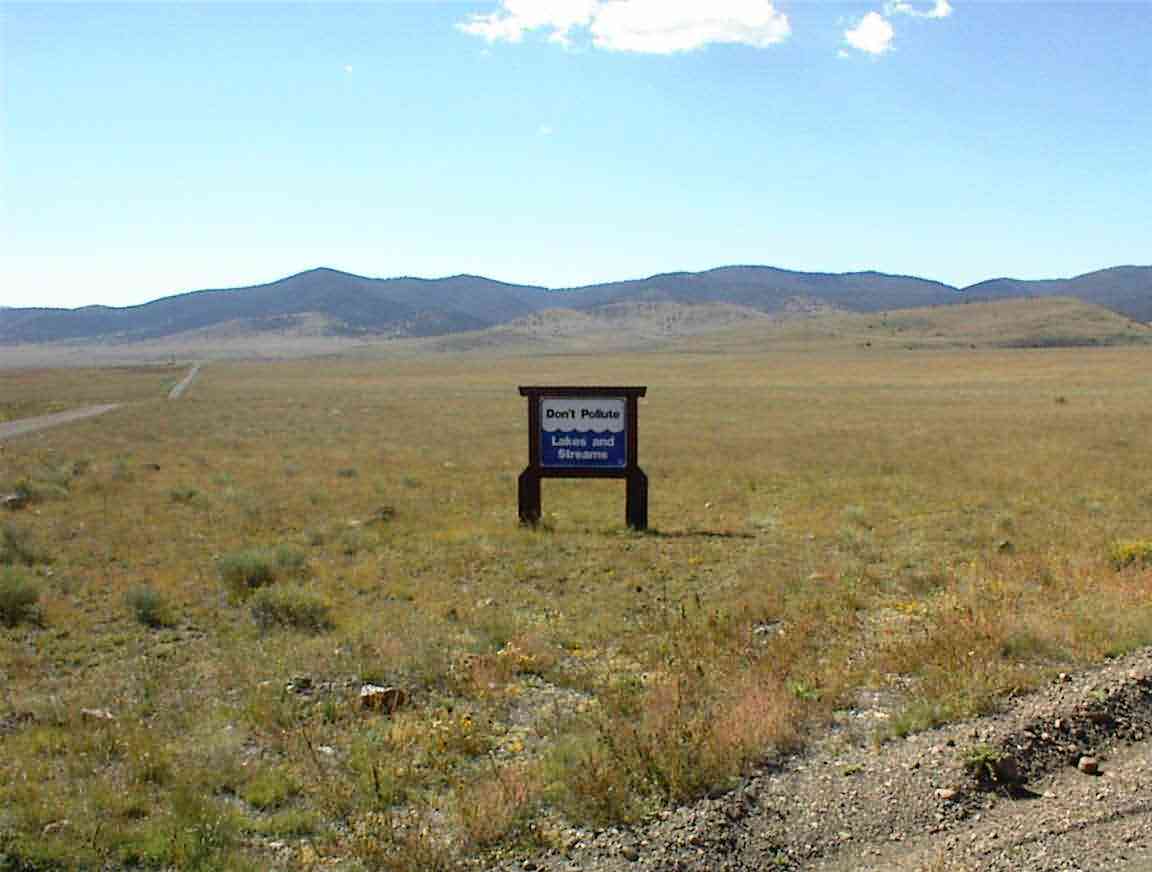
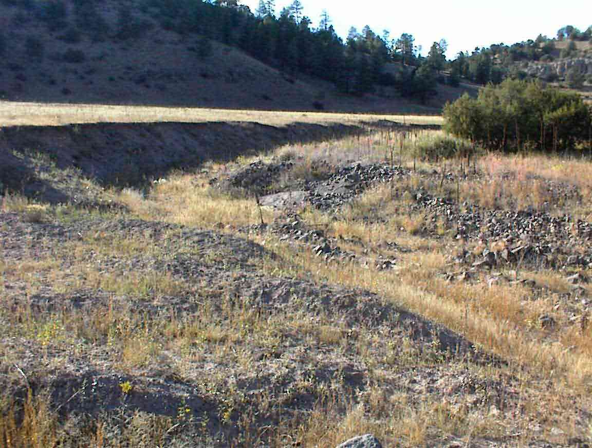
While I realise that I am not travelling during the wettest season, I thought it would be good to give an example of a typical New Mexico 'river' during the month of October. The photo below is typical of the 'flood' conditions which prevail at this time of year. In the context of the above sign, I guess I could contribute to the polution by adding more dust or sand to the river, but really ...
After circuiting the plains I entered into an area where there were many trees on the hills rising to either side. This was the start of Gila National Forest and I would spend the rest of the day, as well as tomorrow, travelling in and out of the forest.
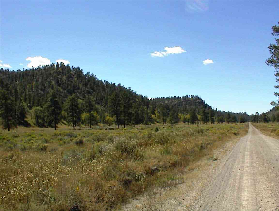
One thing which struck me about the forest, as well as Apache forest yesterday, was the absence of 'scrub' on the forest floor. There were many trees, both fully and partially grown, but there was little dead wood cluttering the forest floor. I had read that scrub catching fire was one of the reasons why they had such catastrophic fires this year and I wondered if they had crews clearing it out. Previously, every forest I had been through had a surplus of scrub -- and thus was at a higher fire risk.
It is interesting to note that there has been a recognition that the forest management plans haven't worked. The goal has been to eliminate fires and this they have been very successful at. However, the Economist magazine showed that while the number of fires has decreased continually this century, the size of the fires has increased at the same time. It is now recognised that small fires are needed to keep the forests healthy, for example by clearing away the scrub, and that they don't endanger the major trees like the Pondersa pines. It is when there is no natural 'clearing' taking place that the major fires happen which cause such problems and reach temperatures where even the biggest trees can't withstand them.
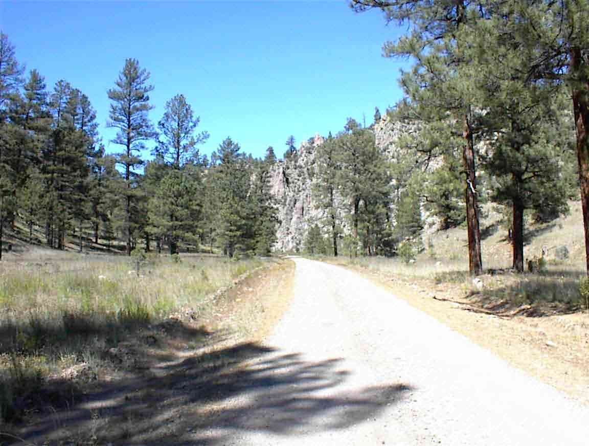
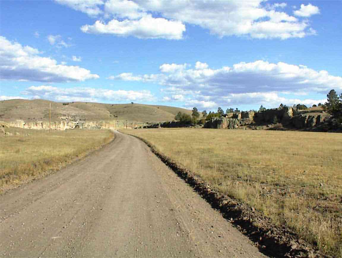
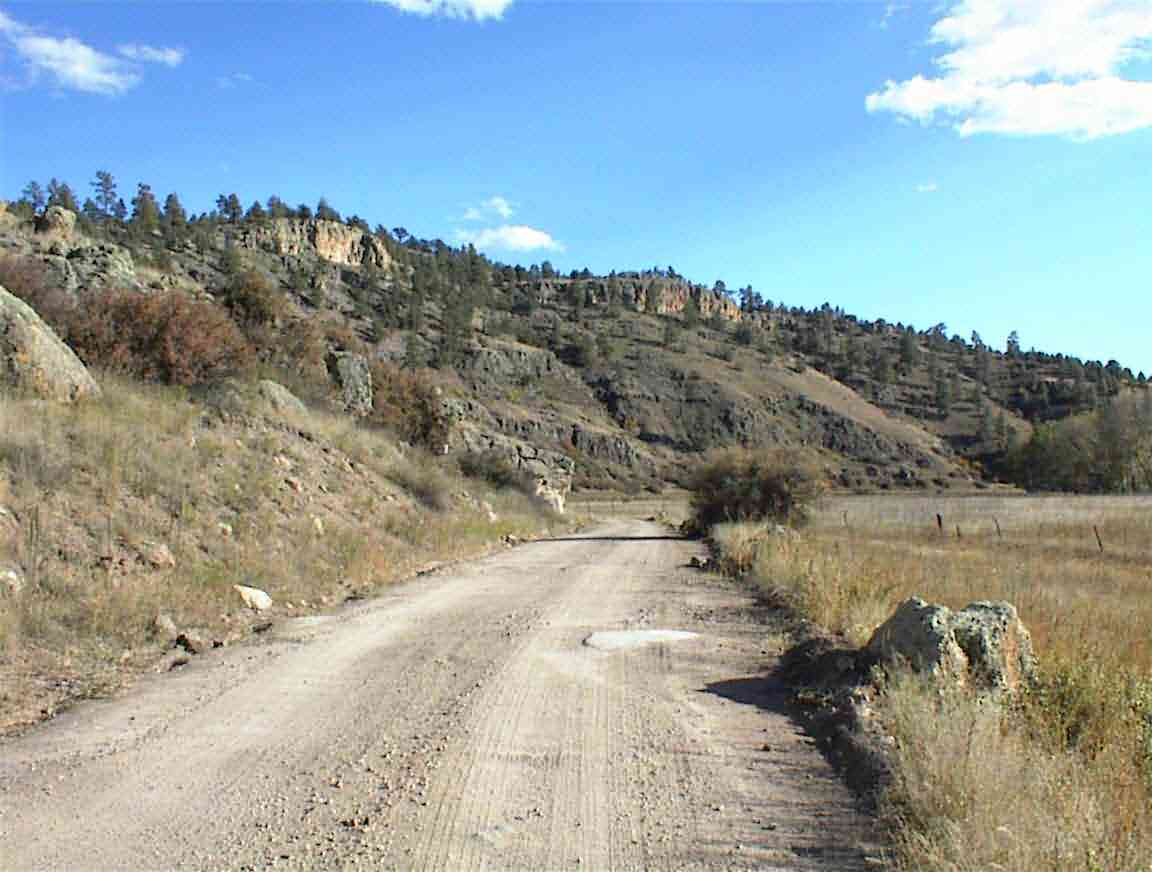
The route took us through these amazing canyons. There were rocks on either side intersperced with trees. I was thinking of the old John Wayne movies where the indians were hidden in the canyon walls and would pick off the naieve troopers as they marched through in columns of three. This was Apache country so the area saw a lot of bloodshed. Just west of here was Fort Tularosa where, in 1872, the US government tried unsuccessfully to get Cochise to halt his raids on Mexicans.
The photos below show the canyons and the lovely pine trees which lined the route. It's a pity I couldn't encapsulate their scent; with a warm day it was rich and delightful.
After exiting the canyons I was again in an area of plains, but at least these had some trees. The road deteriorated to what I call "eunuch's delight". The corrugations were so pronounced that it was impossible not to bounce up and down on one's seat, even at low speed. This presented certain physiological danger to men, and such roads are not recommended if one plans on having children one day. Since Lis and I don't have such plans, I wasn't overly worried ...
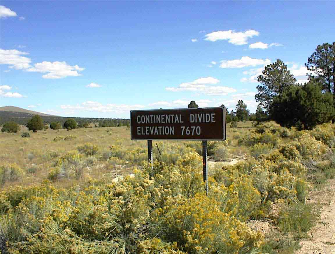
Near Collin's Park the map showed that there was a continental divide crossing, but it was in the middle of a series of roller coaster hills so I wasn't sure which one it was.
The guidebook advised that we camp in this area and I could see why. It was amidst another forest of pine trees and there were many places where a tent could be pitched. Although I had done 42 miles, I still felt quite good and since it was only 14:00 I decided to continue on and see how far I could get that evening.
About 8 miles later I saw the sign below -- my first in New Mexico -- which left no doubt. I wonder how they ascertained that this was the spot given how flat the surrounding terrain is. This was about crossing #29, but it wasn't difficult at all.
The road from the divide was largely downhill and was a great downhill run. In fact, for about 14 miles I had the pleasure of travelling downhill. The road was quite bad in places and I could see how it was that people had to abandon their bicycles in the rain until things dried out. Even with the road dry the cycling was still dangerous in places and I had my trip interrupted when a stone pierced the sidewall of my rear tyre.
I had 'slime' in my tyres which is supposed to seal small holes and it spewed out this flourescent green onto the sidewall so there was no doubt where the puncture was. It soon sealed itself but the cut, although small, looked like there could still be something in the tyre so I removed the tyre and checked it, changing the tube just to be safe.
Engineers have this patron saint called 'Murphy' and Murphy's law states that anything that can go wrong will go wrong. I had no problems with the tyre but when I was standing by the road reassembling my wheel I had *4* pickup trucks with trailers travel by in a convoy. Since the road was very dusty I was absolutely drenched from head to foot in dust. The entire day I saw 5 vehicles on the road, so why is it that 80% of them had to pass me when I was stationary fixing my bicycle? Murphy, that's why.
I travelled down towards the quaintly named 'O-bar-O Canyon' and the scenary was changed yet again. I was back up in northern New Mexico where there was nothing but desert as far as the eye could see.
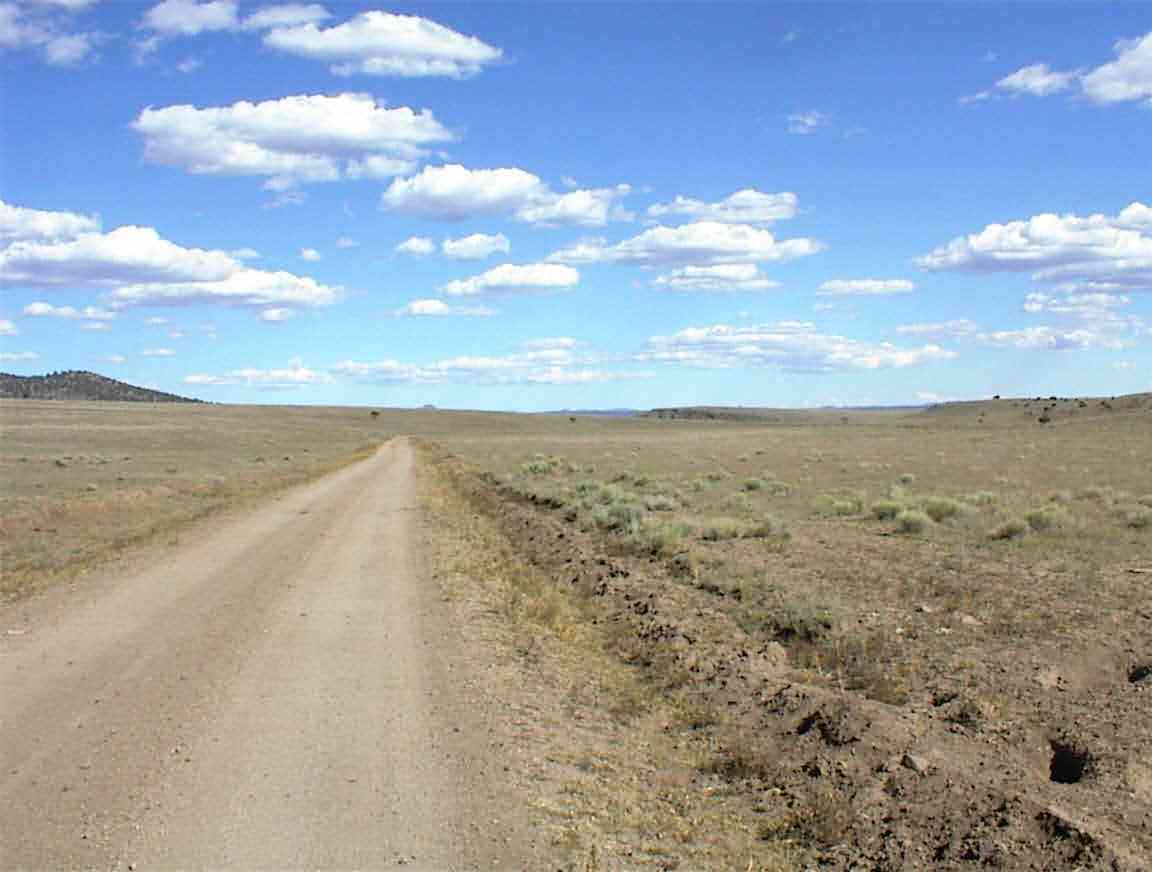
Eventually, I reached the end of the downhill run and was presented with my worst nightmare road (at least when it is dry): a loose sand surface like I had a few days ago before Pie Town. At least this time I was not trying to beat a rain storm so I was able to take it easy, but I still skidded out in places and considered myself to be doing well to maintain a speed of 5 mph on the flat. It was even less when I ascended the hills, but I was given the amazing panorama below as a reward. It was worth it.
Once I crested the hill with the sand I descended into another canyon area. There were colourful rocks rising on each side of the road. They looked like they had a high sulphur content which gave them a myriad of colours. The road was better and I was still descending so it was great fun winding my way through these monoliths. With the sun shining, the wind behind my back, it was great to be alive. I felt so full of life savouring the pleasure of cycling in such an amazing place.
Some miles later the road suddenly deteriorated as it passed through another canyon. This is one of the great paradoxes for me; in the space of a very short distance the road can have totally different materials and be of wildly different conditions. I'd love to be able to chat with a local road engineer to find out why. Perhaps it is due to the way in which the road seems to go in and out of National Forests continually, but then it is marked as a forest road for the full length.
A digression. Throughout the afternoon I cycled through hordes of grasshoppers and I was able to make two observations that may be of interest. Firstly, I never knew that they were canibals. Often, I would disturb a gaggle of three or four grasshoppers that were standing around the squashed cadaver of one of their erstwhile friends. It definitely looked like they were having a meal of it. Secondly, the female seems to be larger than the male. I also disturbed a large number of grasshoppers where a large one was on the bottom with a smaller one on his/her back. Anyway, back to my travels ...
It was getting late in the day and I was looking forward to reaching my destination. Water was the primary concern and I was aiming for the Beaverhead Work Center which is a Forestry Service depot. It was the only place I could guarantee getting water since most, if not all, the other potential sources had been dry so far. I was therefore pleased to arrive at the center and find that there was a sign directing me to water, and even a phone booth so I could call Lis.
This seemed like a good place to camp so I wandered around trying to find someone to ask permission of. Three men drove up in a forestry truck and they were most helpful, directing me to camp in front of their office. I set my tent up and had a huge dinner -- I had earned it.
There was a large moving truck parked in the lot and the movers were shifting the contents to a smaller truck to move up the mountain where the main truck could not go. A couple had retired from Washington D.C. and I was amazed to see how much stuff they had sent down. At least Lis manages to throw out a lot of our stuff when we have our regular moves.
A fellow came up asking for directions to some people who lived nearby. He was delivering a new caravan to them from the factory in Indiana. It transpired that it was the same couple that the movers were here for so Mike sat down to wait for the next shuttle so he could follow them.
He said that he spent his time driving all over the country delivering these caravans which are worth about $USD 30,000. He gets paid $1 per mile and so had earned $2000 for this trip. Seems like a pretty good job if you are the nomadic type. He lived in Pennsylvania and was intrigued by my trip. Mike had done some parts of the Appalachin Trail in Pennsylvania, but wasn't keen on anything major like I've done. I asked him if he had read Bill Bryson's book on the Appalachin Trail (A Walk in the Woods) but he hadn't. Probably a good thing as Bill was not very complementary of the Pennsylvania section.
Eventually everyone moved off and I got stuck into my journal. It's going to be another cold night even though the ranger assured me that it was warmer here than where I was yesterday. Since it was in the high 20's last night here, it must have been lower than that where I was. It felt like it. Hopefully I'll sleep better tonight as I'm going to wear my down jacket to bed. Yes, pretty pathetic, but I cope best in the tropics and winter is definitely approaching fast. Good thing I'm almost done.