Day 31: Battle Creek to Steamboat Springs - 61 miles
The day was very humid and my tent was wet with condensation. As usual I was the first one up and it was bitterly cold. Undoubtedly a combination of the temperature and moisture. I decided to cook something hot for breakfast and it was quite the exercise. My fingers were so numb I couldn't flick the lighter enough to get a flame! Pathetic or what? Eventually I managed to warm them enough to get the stove started, but it stopped before the water got boiled. At least we had warm water with our cereal.
After packing up we headed out, downhill further into the valley. The road was not too bad, although there were some very muddy patches. We then started climbing steeply out of the valley which necessitated removing some of the layers of clothing. This was to be a repeated exercise throughout the day; when descending into valleys it was bitterly cold, when climbing out it was like being in a sauna.
For the first time on our trip we came across sheep. Compared to NZ sheep they were a pretty pathetic looking herd. Not too surprising though, given that there is little grass to live off and they must find sustinance from the scrub which covers the ground. What was very unusual was that a few of them were wearing collars with cow bells on them. Seriously! They were often very large sheep, and looked older than many of the others. We couldn't reason why this was done.
The climb out of the valley was lung bursting and much of it was done in my absolutely lowest gear, giving me the grand speed of about 3 mph. At least we weren't trying to do this on a loose gravel road or in the rain and we were also given a beautiful tree lined route up the hill. All in all it was much better than many that we had been on recently and Sean didn't seem to mind much either. He has regained some of his enthusiasm after the night's break.
Eventually we topped out and then enjoyed a ride along rolling terrain with some good fun downhill runs and not too bad uphill runs. We came to an unmarked fork in the road and were presented with a delemma: which way to go. Although our first impression was to go straight, we had been on road 801 and this now headed off to the right. After reviewing the map and checking the general direction with my compass we decided to continue on 801 and so right we turned. It was to prove to be a mistake.
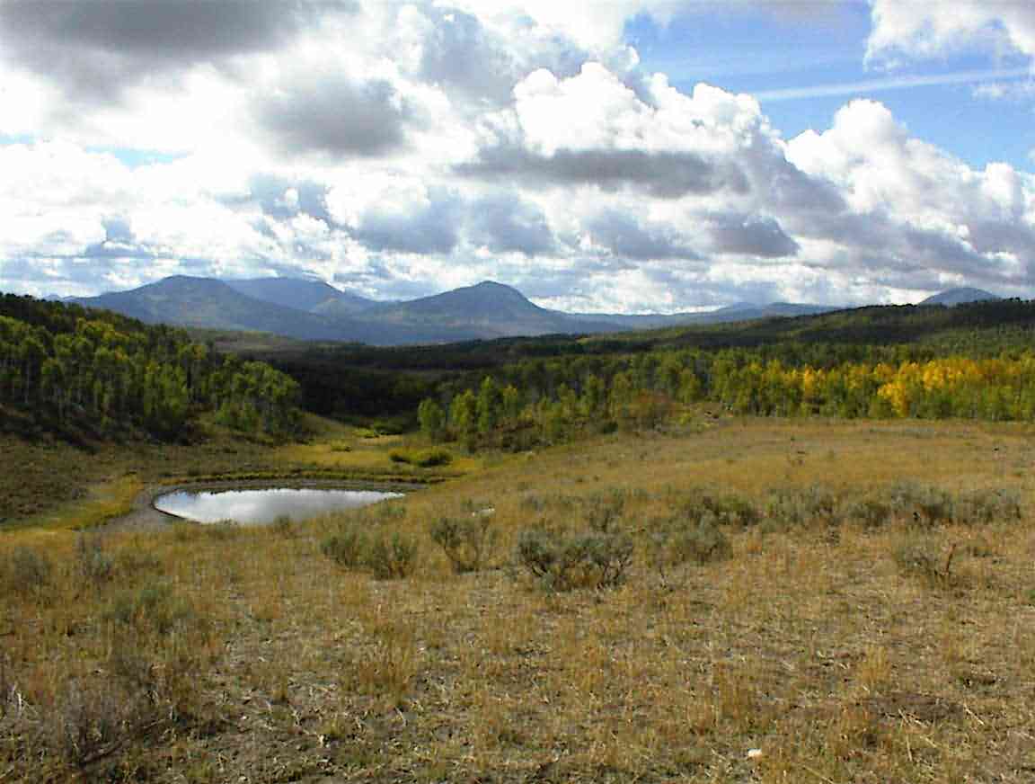
The road took us down through meadows and woods and the temperature dropped quite markedly so it was on with more layers. The road turned into mud and then became a 4x4 track, however, since it was continuing in the right direction we decided to continue. At one spot there was a large pond in the road and I cycled along the edge to avoid it. That is until I hit a trench which threw me towards the pond. The rest of the day I cycled with cold, wet feet but at least I kept the bike upright and the panniers didn't get too wet. The scenary was spectacular, as can be seen from the photo below.
After travelling some distance we came across two hunters who had a better map than ours. It transpired that we were on the wrong route and it ended at a farm a mile or so down the road. Our target road was about 2 miles past that, but across private property with lots of 'No Tresspassing' signs. The latter seem to be a popular commodity out here as they are put up everywhere.
We decided to press on and play the lost tourist (which we were) in the event that we had any hassles. It would take someone particularly hard hearted to send us back up where we came. As we entered the property I surprised a deer in a gulley near the road. It bounded off in a fright. We came to a locked gate on the road and decided to follow the fence line which ran parallel to the road. When we got to the end and were about to hoist our bikes over the fence I saw someone on a farm bike coming up the road. Blast. We were discovered.
I hopped the fence and went to have a chat and plead mercy. It wasn't necessary as Maureen was very friendly and didn't seem to mind finding us on her property. She said that we shouldn't have turned (which we knew) but also that the other route also took us across private property so we would have been in a bind either way. Their farm straddled the Wyoming/Colorado border so at the time we were still in Wyoming but shortly would be in Colorado. I commented that this must make life complicated and she heartily agreed; they were in a dispute with a neighbour and it was being done in two courts, in two states.
She gave us directions to road 129 and wished us luck on our cycling. After we hoisted our bikes over the fence we cycled down past their house and along the drive before reaching the road. Was I ever glad that we had made it, but we still had a very long way to go.
We cycled SW along road 129 which was the 'Alternate' route to the main road. The latter took us 1500' higher over the watershed and since it wasn't the continental divide we decided to wuss out and take the 'easier' route. I say 'easier' because it was still mighty hard with lots of ups (and a few downs) taking us up to 8700'.
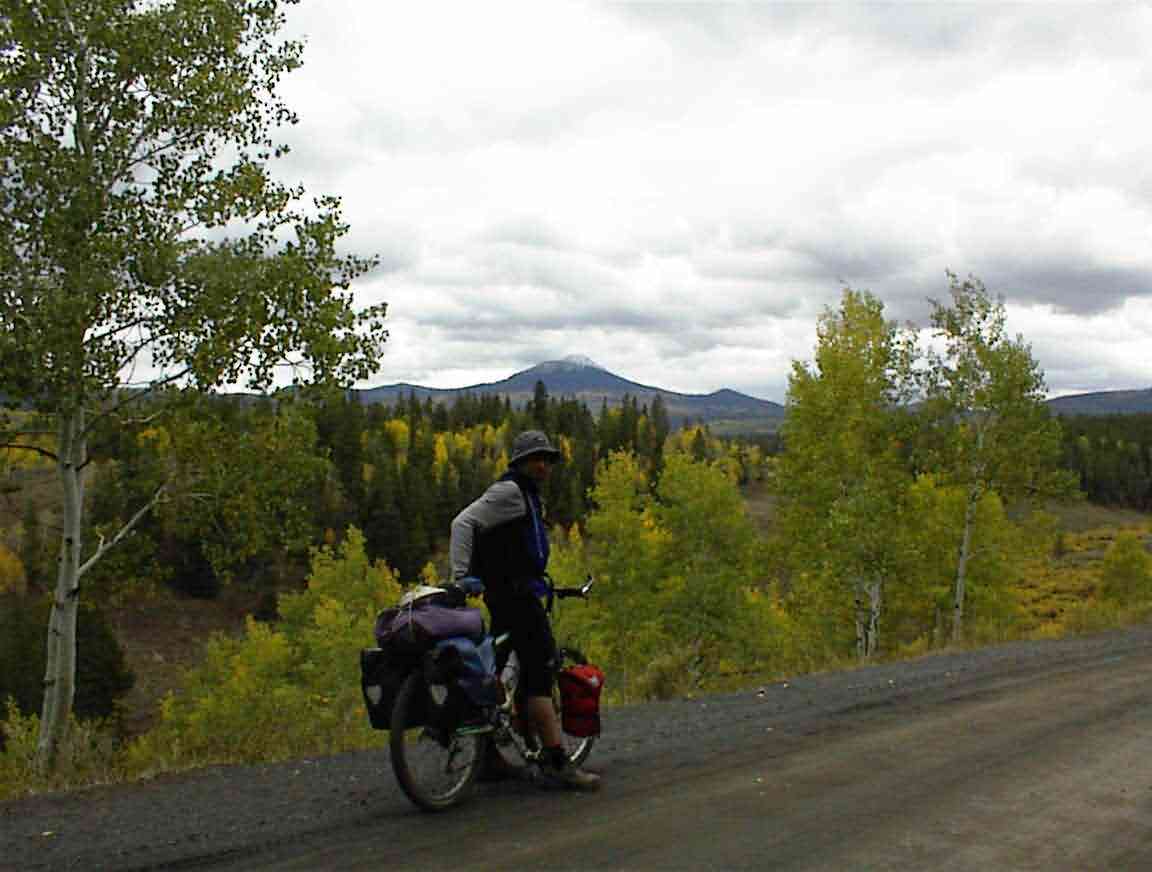
For a change there was no headwind and we made good progress except for the slow climbs up the hills. The area was much lovelier than Wyoming, with lots of farms which were well watered. And trees! It was great to be back in trees again after the desert areas we had been cycling through. There were many aspens and with their leaves changing we were often presented with golden sentinals lining the road. The drawback was that it was a cold and overcast day, but it could have been a lot worse.
We passed this huge ranch called the 'Three Forks'. The place smelled of money as there were many large buildings, all in an excellent state of repair, and even the gate posts were huge, built from stones. Sean wanted to pop in and see if they sold lunch but I told him that it was not the sort of place that looked like they wanted casual visitors, particularly looking as rough as we did. We found out later that it is owned by the third wealthiest man in the USA which accounts for its size (thousands of acres) and the quality of the upkeep.
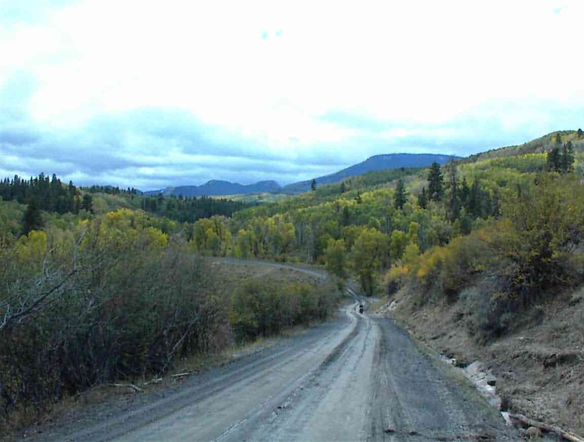
The road took us up higher into the moutnains and there was even snow on the distant peaks which you may be able to see from the photo below.
After stopping in the aspens for some energy bars we decided to press on to Columbine (not the place of the high school shooting a few years ago) in the hope of getting something warm to eat. We continued to climb and the last few miles were particularly gruelling. The road went through a beautiful rock gorge, but I was busy focusing on keeping the pedals turning. It was very hard work. At one corner I surprised some more deer who bounded off, but save for the occasional car I had the road to myself. Sean had fallen behind.
Eventually the unsealed road finished and I reached tarmac. This meant that Columbine was not too far away and I was very pleased. When we reached the village I worked out why I was finding it so difficult: the altitude. We were at 8700'.
There was a shop in town and we stopped. There were two fellows outside who said the word 'big' as 'beeeeeg'. I asked what part of Australia they were from and they said Sydney. I was very cold, especially my wet feet, so I went inside while Sean yarned with them. The shop was tiny but there was a wood burning stove which was just what I needed. As I warmed up next to it the elderly woman proprietor gave me a cup of warm cider and I had some corn chips which was the only food she had. I took a cup of cider outside to Sean who is much more impervious to cold than I am, although he did later join me inside when the Aussies left. The woman advised us to go 5 miles down the road (literally since we were at the high point of the road) where there was a cafe and we could get a meal.
It was a great downhill run and I hit over 30 mph. On our left was Hahn's Peak which had a light dusting of snow; on our right we passed Steamboat Lake which is a popular vacation resort. Just past the visitor's centre we spied the cafe and were pleased to find it still open. It was after 15:00 and we were hungry.
The place was empty save for the woman owner and another patron called Mark. When we told the owner that we wanted food she enthusiasticly said 'all right', explaining that most mountain bikers only ordered drinks. I was in an unsocial mood (too cold to be bothered) so I buried my nose in a Reader's Digest I found there while Sean chatted with Mark about our trip. He was a local well digger and was originally from Missouri. He was amazed by our trip.
The cafe served Mexican food and we both had a delightful stew which really filled a hole. Coupled with a hearty serving of corn chips, four tacos, and two hot chocolates (each) we were ready to hit the road for our last 30 miles to Steamboat Springs. When we went to pay it transpired that Mark had already paid for us! I was embarassed by his kindness, but it was most appreciated.
We were advised that it was largely dowhill to Steamboat and this was good news. It took us under 2.5 h to make the 30 miles and the cycling was much easier than anything we have had for quite a few days. The road took us past many affluent farms with lots of green grass and trees. This part of Colorado is a lot wealthier than elsewhere we have been.
The road took us next to the Steamboat river and the land adjacent to the river was a continuum of 'No Trespassing' signs. On the opposite bank of the river was a huge house which even had its own private bridge (similar to what we have on State Highways in NZ). Later, I saw a magazine on property prices in the area and they seem to regularly run to $5 million (US) and upwards. Even what I would consider to be 'average' houses don't leave much change from $0.5 million. Popular spot this.
When we reached town Sean pointed out the first motel and we stopped there. It was the same one I stopped at two years ago when I hit Steamboat so I didn't mind staying there again. After checking in I called the office in NZ and we then wandered into town so Sean could get something to eat.
Steamboat Springs is a neat place and Sean has decided to spend his last few days here before he heads home. Good call. There are lots of restaurants, shops and things to do in the area. We found a diner and I had an ice cream while Sean had a BLT sandwich. They were a bit slow with their service so I went back to the hotel to call Lis while Sean finished dinner.
Lis was not around so I enjoyed a relaxing bath and read the local newspaper. It was great to wind down and relax. When Sean came back we looked at the maps and agreed that the next 2 weeks are going to be pretty rough. Hopefully I'll be up to the altitudes and the hard climbs. If I make this, Mexico will be pretty easy!